


Craft Projects Index
Our successful geospatial web application in the government sector. You can see you customize the application in various needs, and we are improving develop technology for the best solution from 2004 to the present.
Our mapping and IoT framework, Vallaris, and JetStream are the key application platform for us in delivering projects!
Vallaris
Jetstream
Our Craft Projects
More than 70 Geospatial projects with government and private sector by our company.If you have a spatial idea and would like to make it happen Why not? Contact Us →
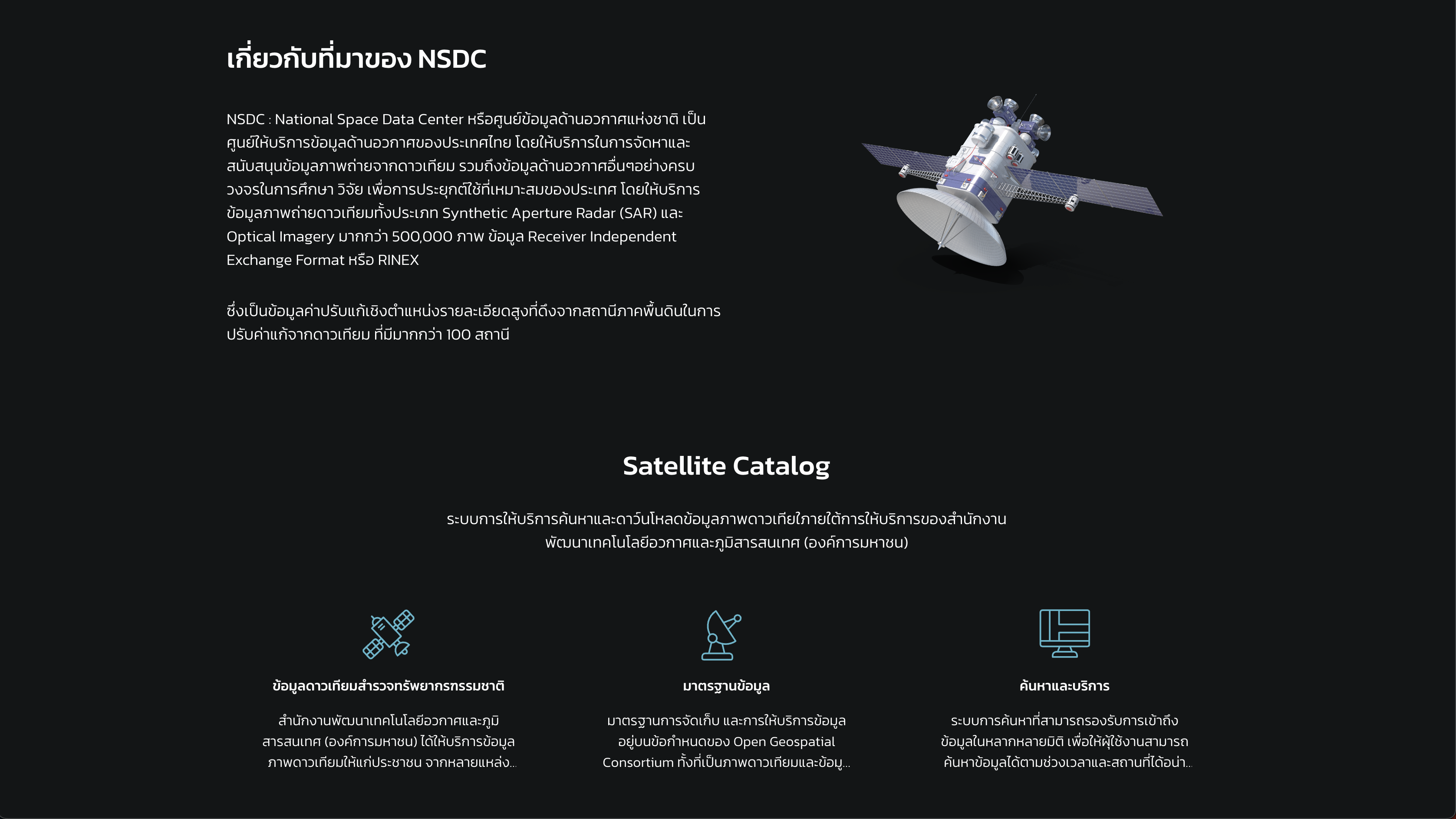
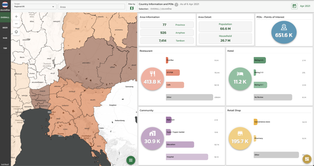
GISTDA: National Space Data Center
National Space Data Center is space data services center of Thailand which provide the satellite imagery and other space-related data for research and academic in advance application. The system has provided over 500,000 archives of Optical Imagery and SAR Imagery.
Vallais Maps was a system behind National Space Data Center that has been operating since store management to services.
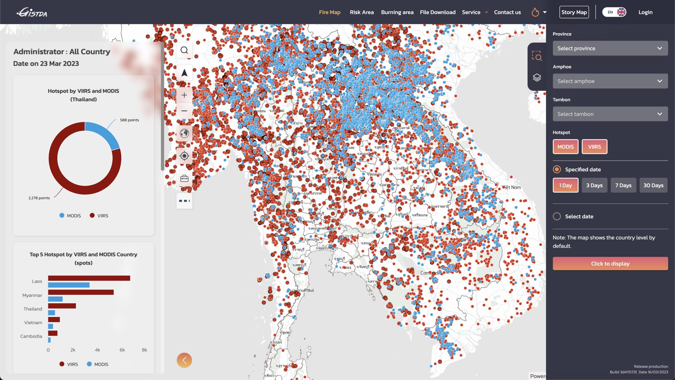
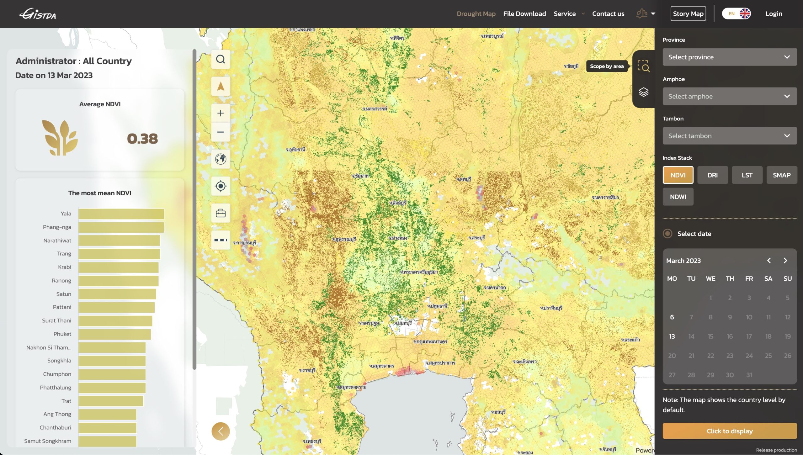
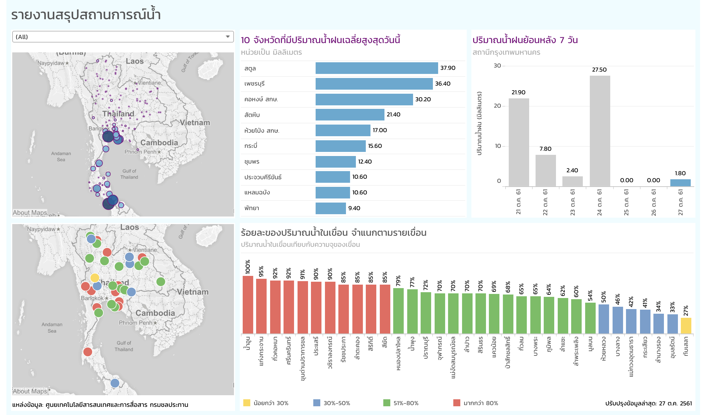
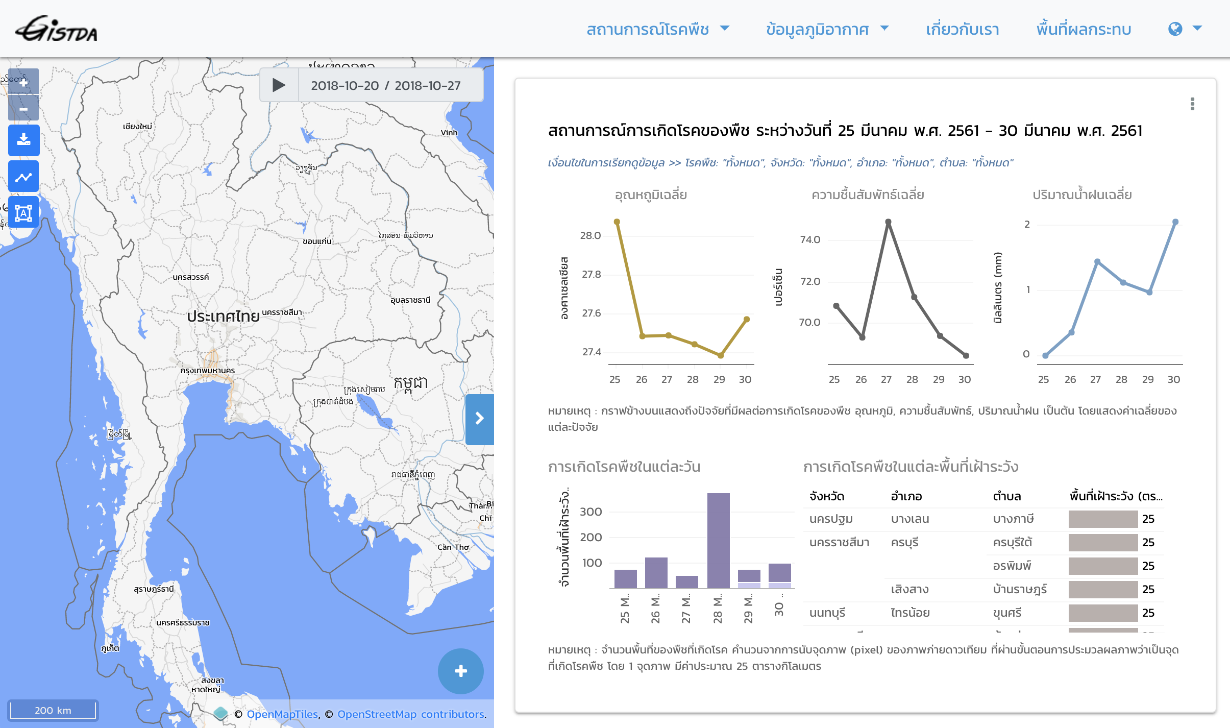
GISTDA Disaster Platform
GISTDA Disaster Platform was designed for 3 disaster types e.g. Flood, Fire and Drought in Thailand. Platform provides the latest updated disaster data in spatial and dashboard visualization. Also, provide the data services in OGC Standard and STAC
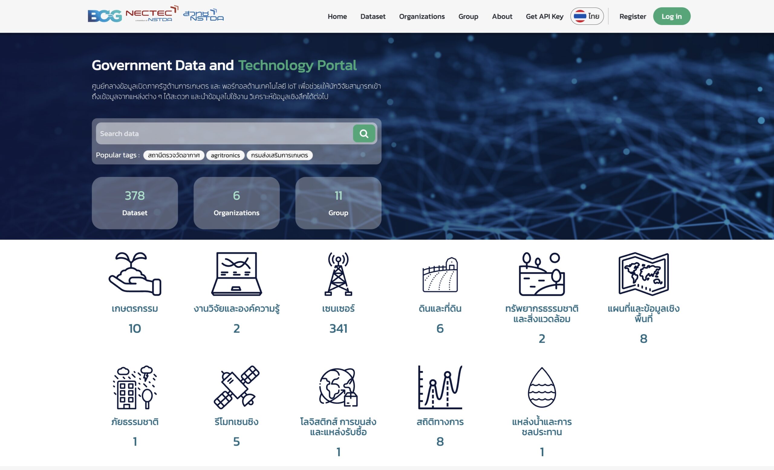
GovTech and Farmer One
GovTech and Farmer One are web applications that provide open data through CKAN platform. All services are in RESTful API. You can explore thousand of services from this application.
Vallaris Analytics is behind this system as middle-ware to connect multiple sources of data.
TSPACE Digital: Area Management Platform
TSpace Digital and i-bitz company limited have co-operate the Area Management Platform (AMP) to escalate sales and goods distribution in area of Thailand and ASEAN Country.
TSpace using Vallaris as mapping platform in data visalization and data processing with insight data.
Vallaris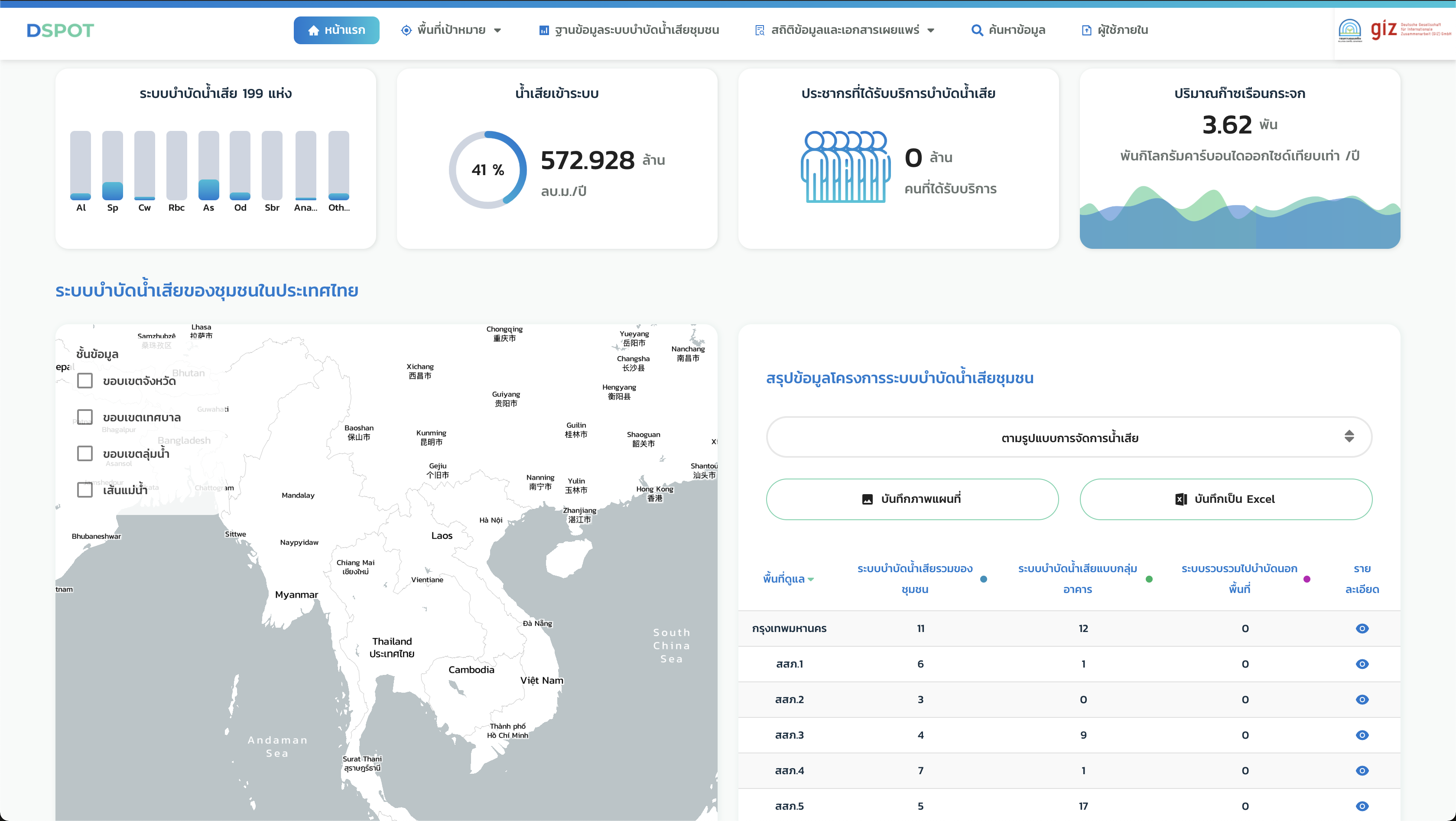
DSPOT : Pollution Control Department and GIZ
Database System for Publicity Owned Treatment Works
The reporting system for publicity owned treatment works who need to report treatment system capacity in term on operation and econimic and management to center (Pollution Control Department, Thailand). This system has nice user interface design, coming with powerful map engine. Moreover, system was open data such as treatment location and statistical data.
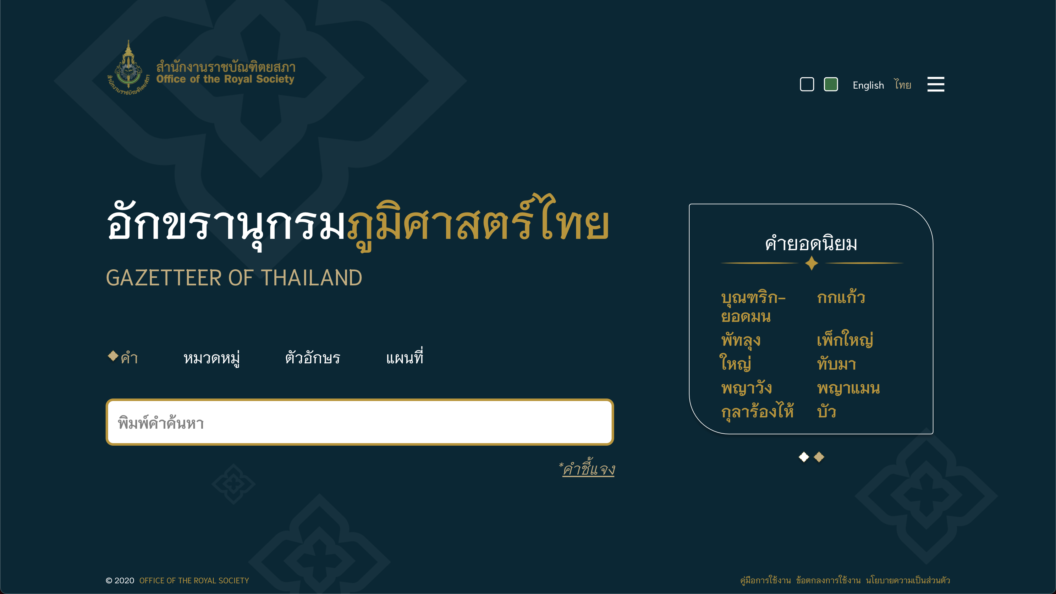
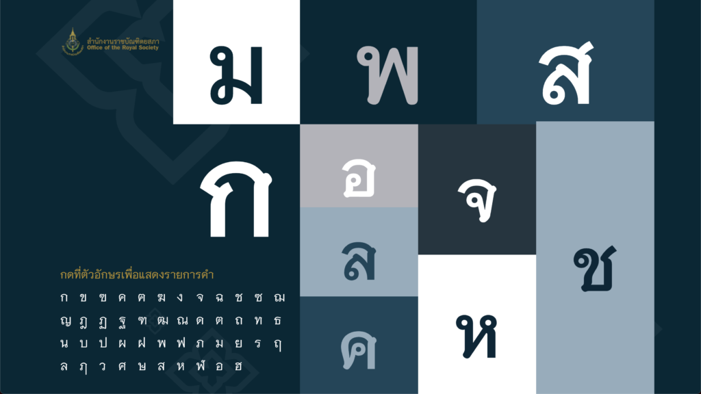
Gazetteer of Thailand : Office of the Royal Society
Gazetteer of Thailand : Office of the Royal Society
The official Gazetteer is a geographical index or dictionary of Thailand under the Office of the Royal Society. You can search geographic location from name or map with rich information on its.
Beyond the services with OGC API - Features Part1 compliance from Office of the Royal Society.
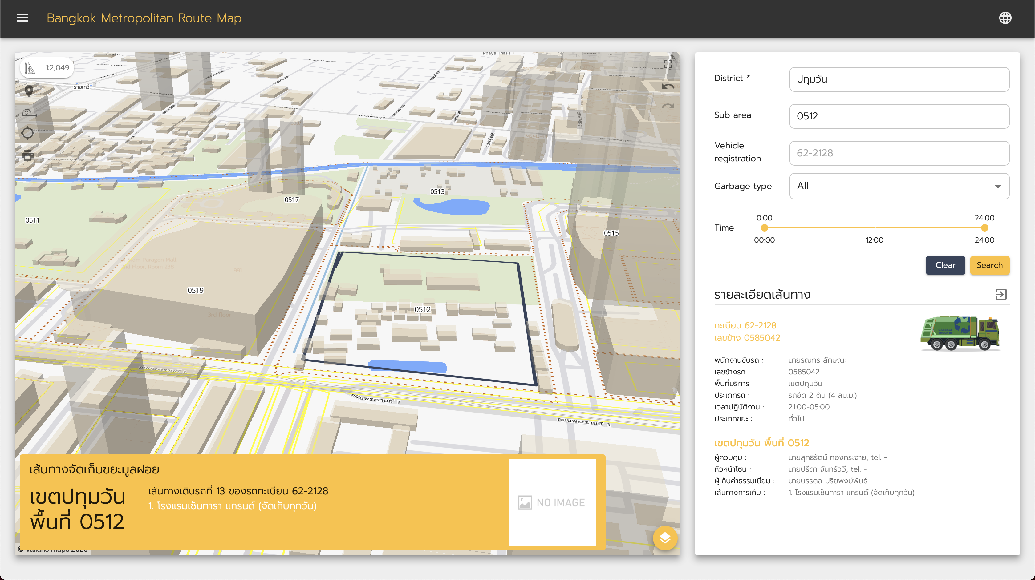
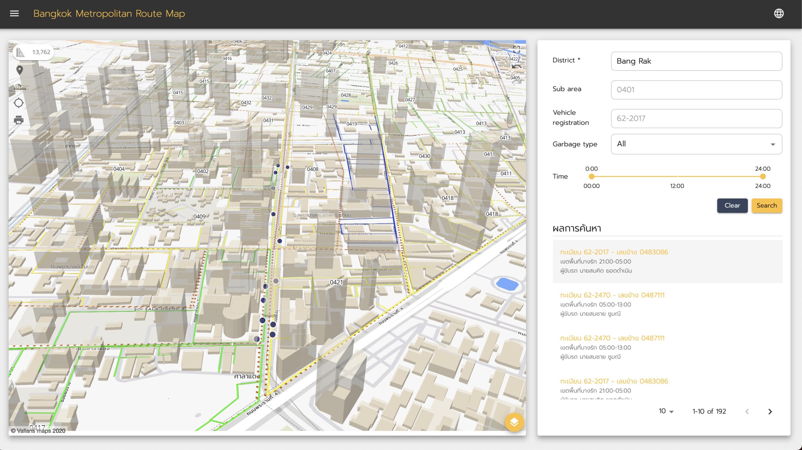
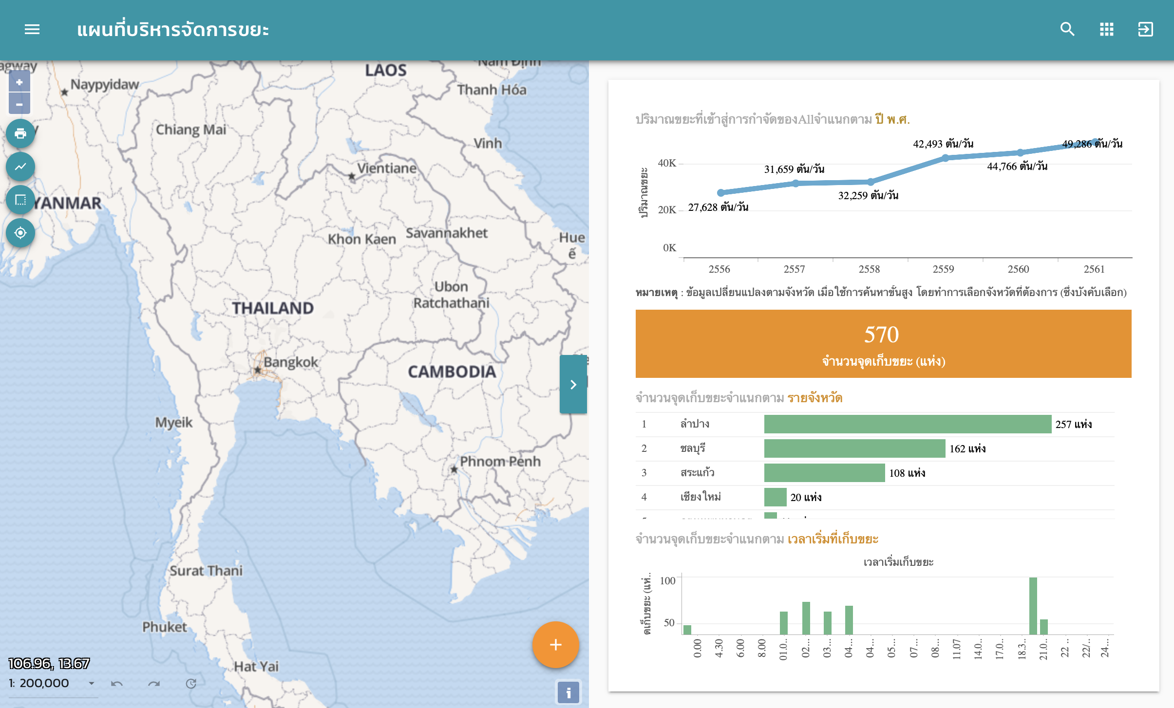
Bangkok Route Map for wasted management : BMA
Bangkok Route Map for Wasted Management : Bangkok Metropolitan Administrator
This mapping application is a part of main application to management domestic waste of BMA. Application provide the route map for collection domestic waste in Bangkok Area. Vallairs 2.0.0 was laid core layer in data store and provide services to the application.
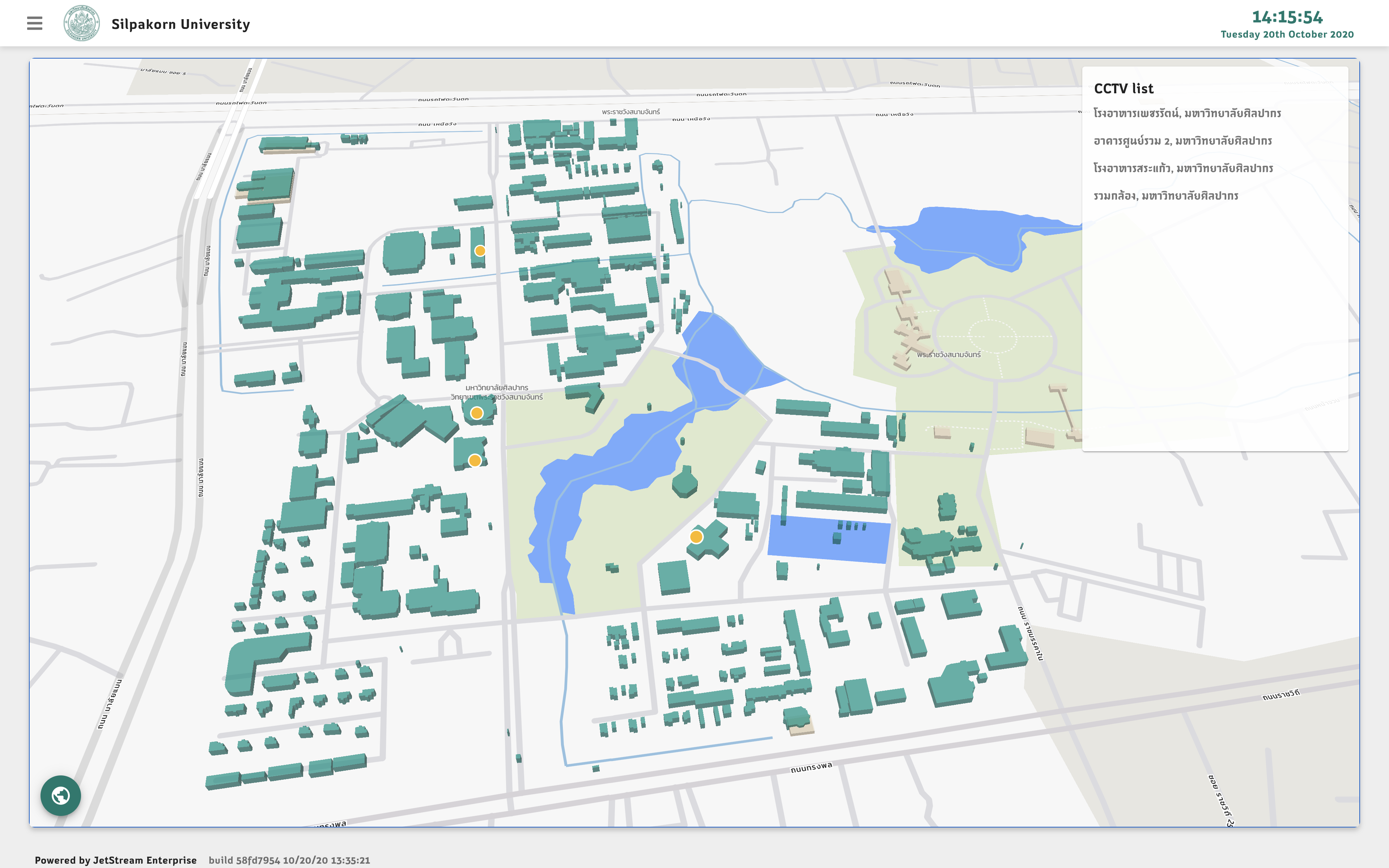
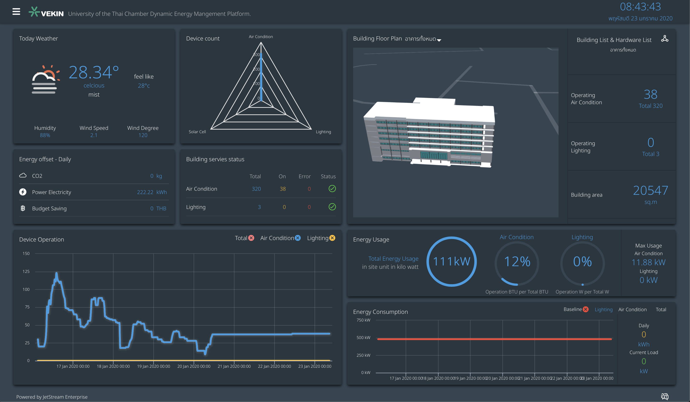
Silpakorn University - The CCTV Dashboard
Silpakorn University - Sanam Chandra Palace Campus. JetStream and Vallaris as the base software infrastructure for mapping and streaming video data. Under the constraint that multi-sources of VMS, JetStream is IoT data platform who integrated it together,
JetStream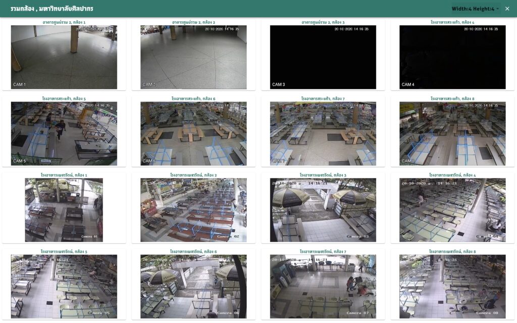
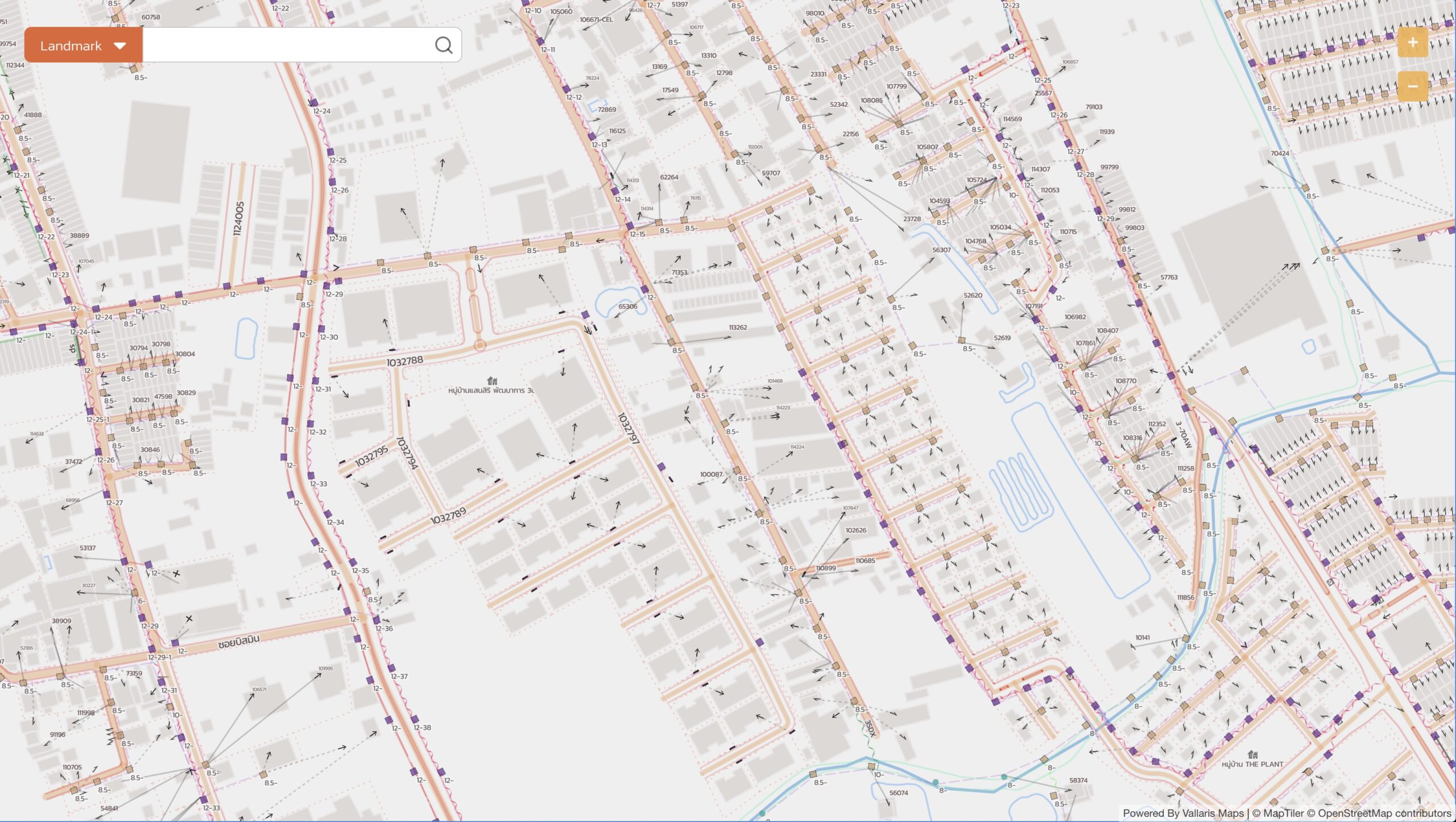
Metropolitan Electricity Authority - Open Geospatial Data API
Metropolitan Electricity Authority Data API
This is the first-time Metropolitan Electricity Authority open geospatial data as API that following OGC API - Features, you can access detials geospatial data on 1:1,000 from MEA
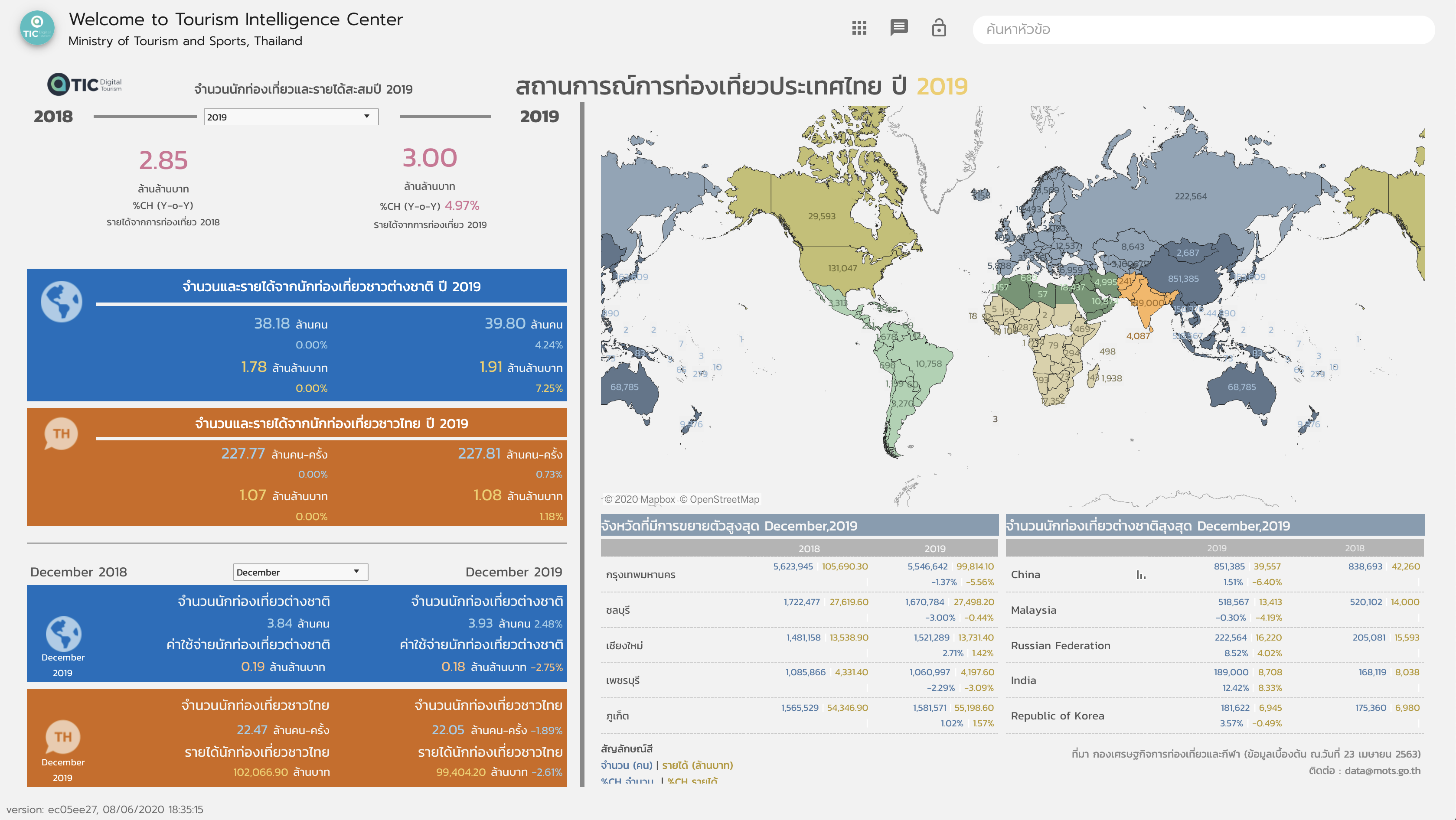
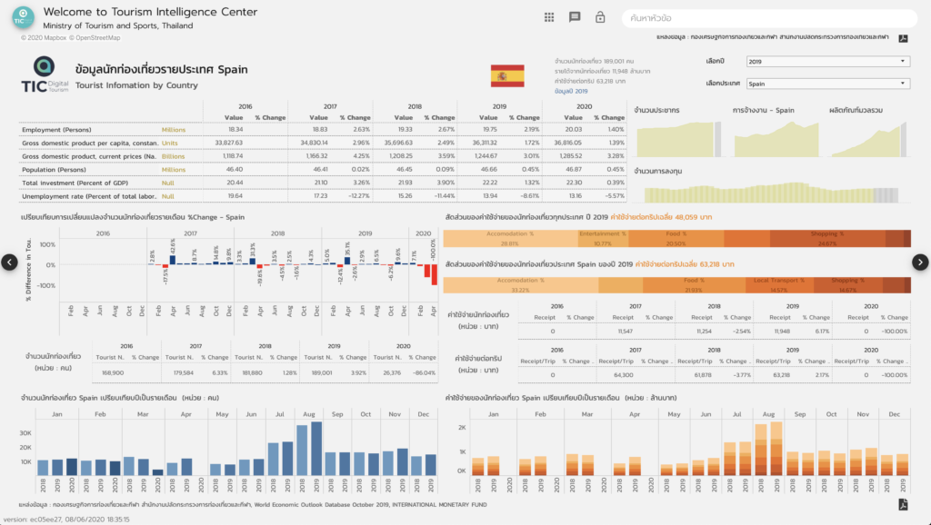
Tourism Intelligence Center - Ministry of Tourism and Sports
Tourism Intelligence Center is Thailand tourism data portal of Ministry of Tourism and Sports, Thailand. Information has been display on several dashboards. More than 8 angels of Tourism data of Thailand.
GISTDA Spatial Data Service
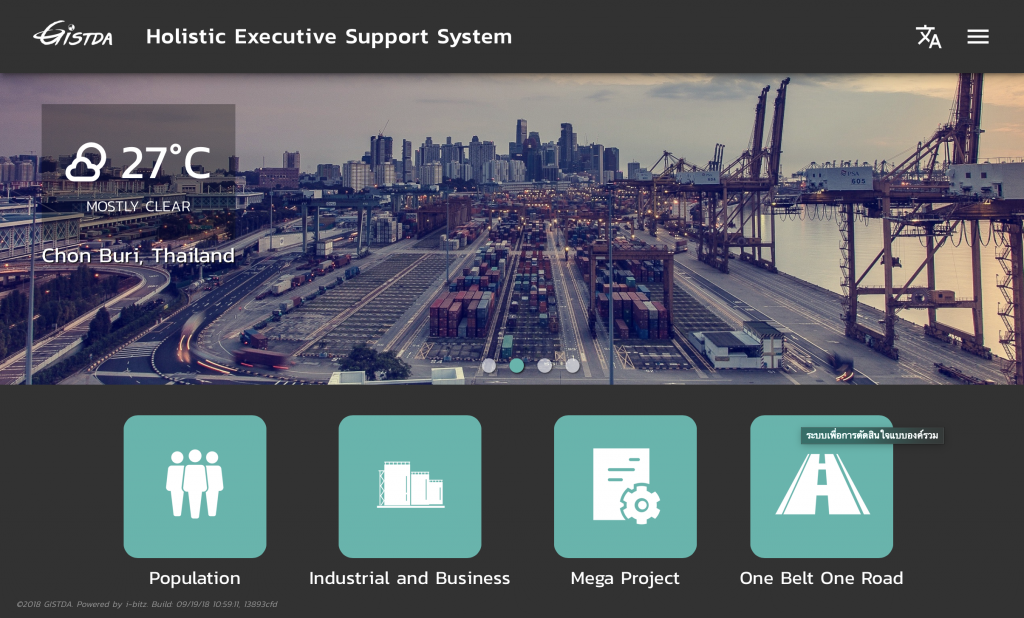
Holistic Executive Support System
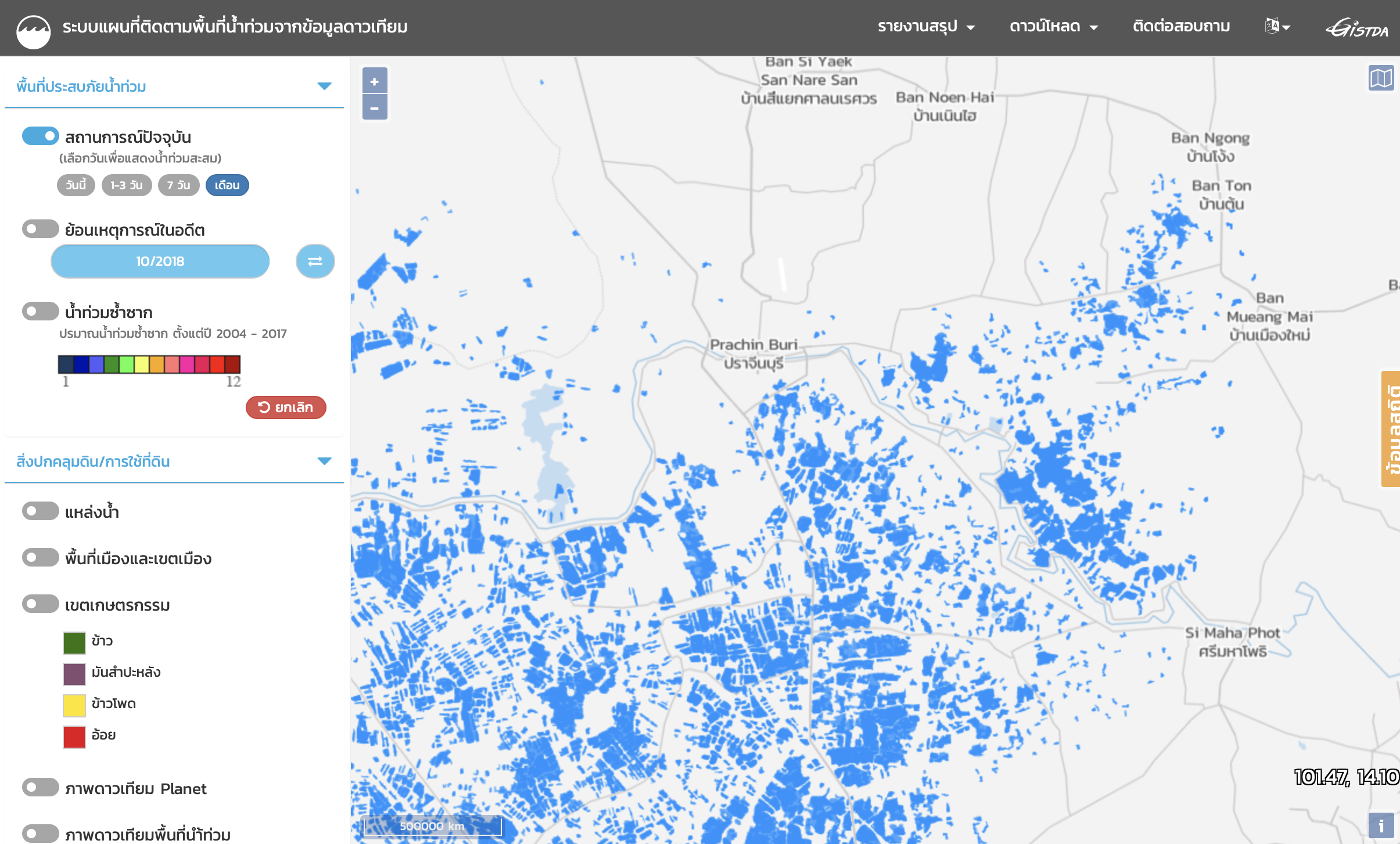
GISTDA Flood Application
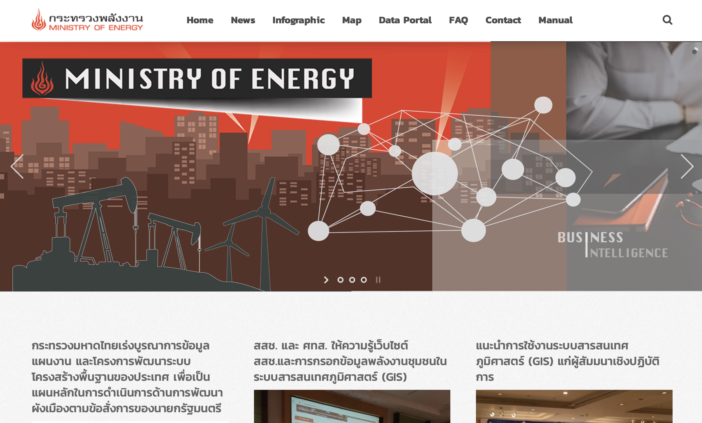
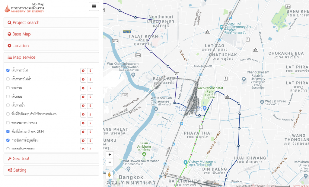
Ministry of Energy
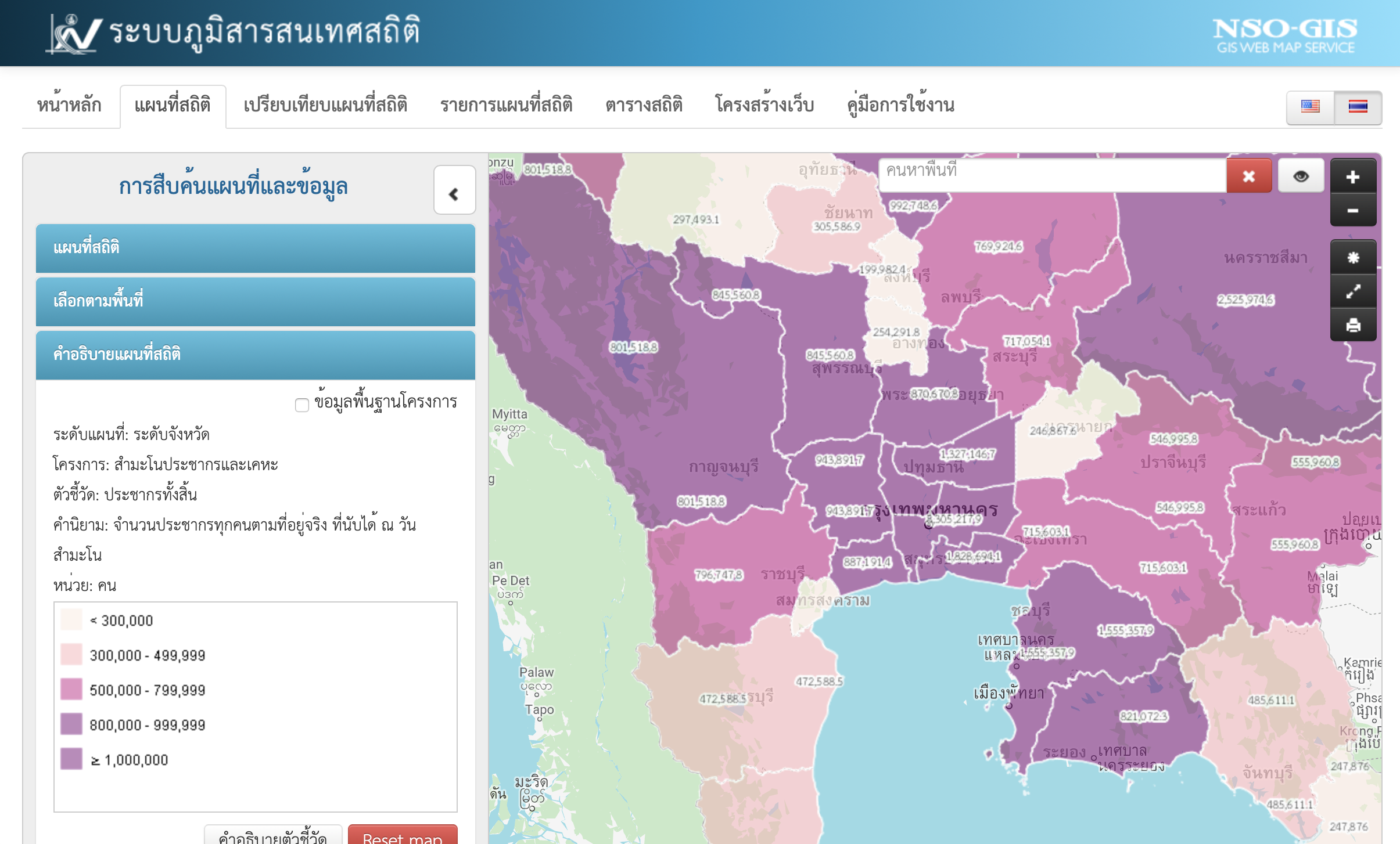
National Statistical Office
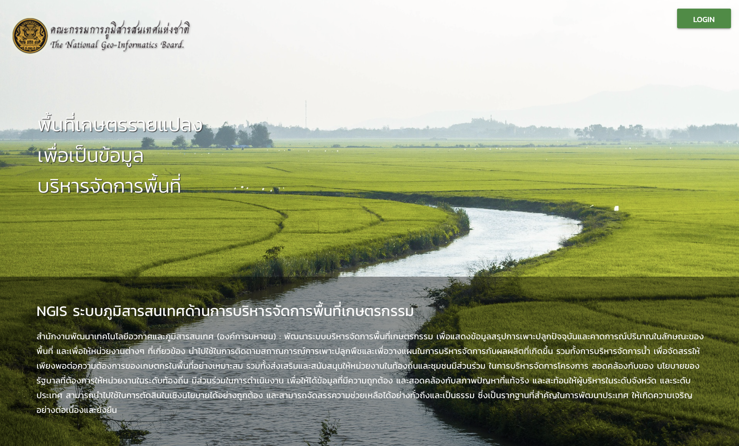
The National Geo-Informatics Board
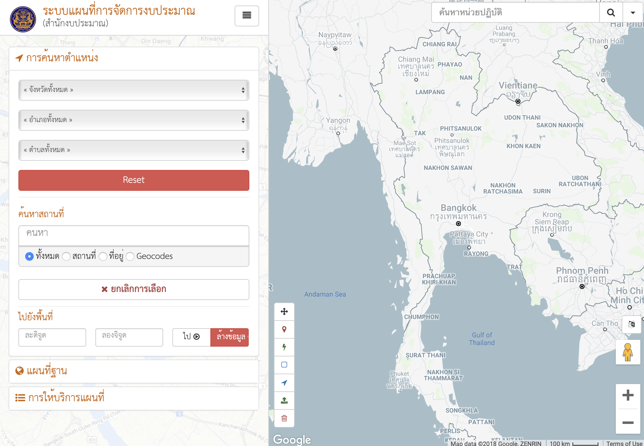
Bureau of the Budget
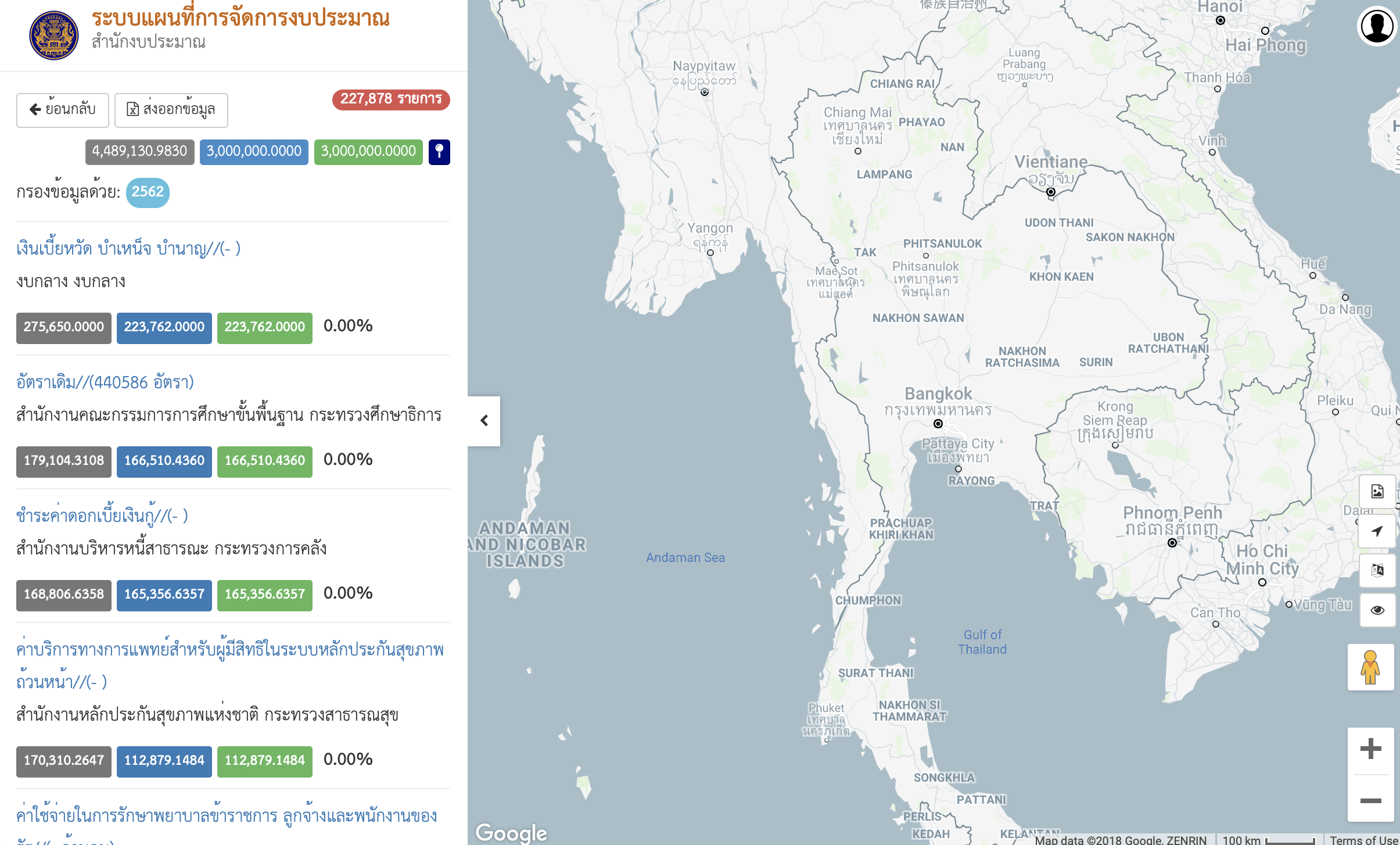
Bureau of the Budget
e-Budgeting GIS is system for Thailand's budgeting monitoring allocate by area and function.
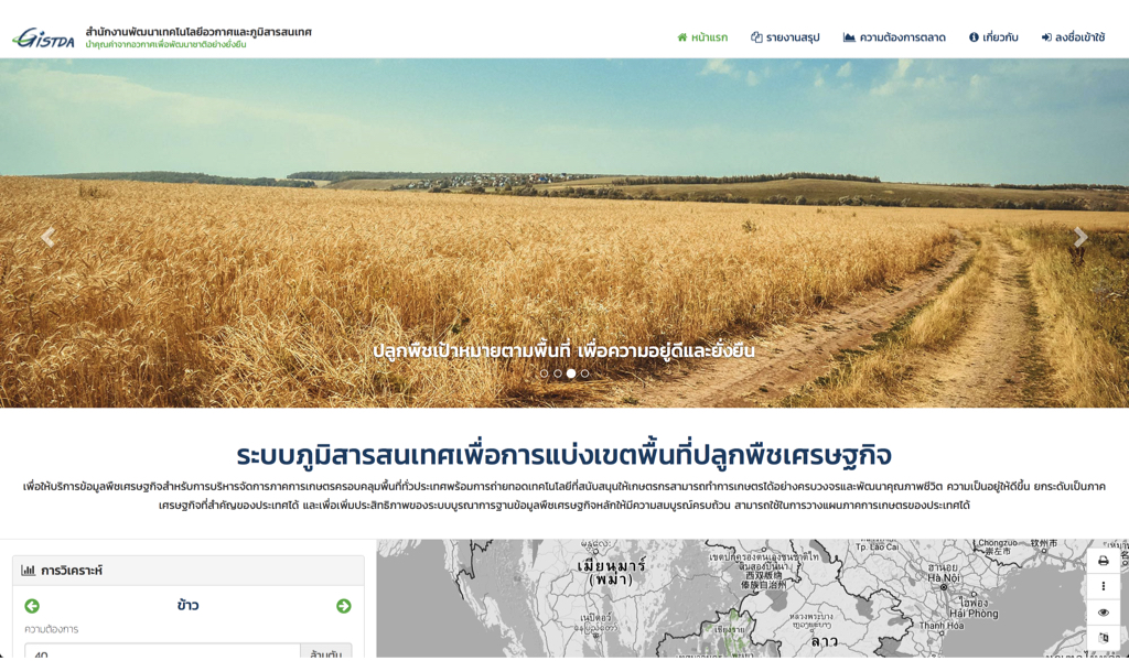
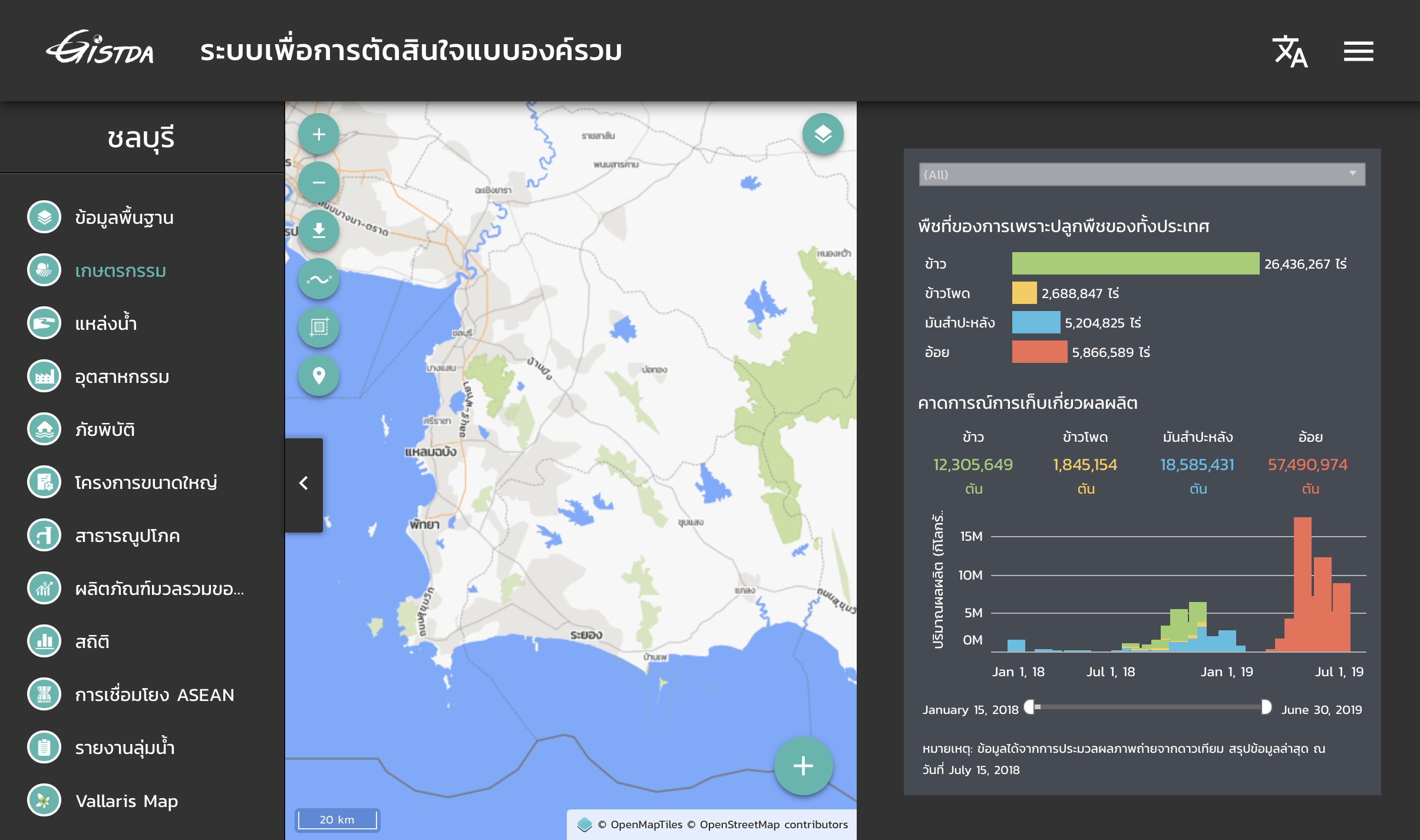
GISTDA Agriculture Zoning
Bureau of the Budget
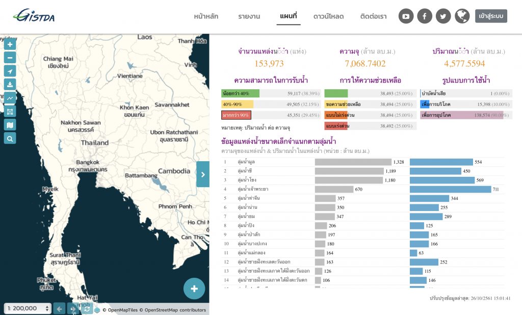
GISTDA Small Water Area
GISTDA Policy Impact
ShutterRunning Register System
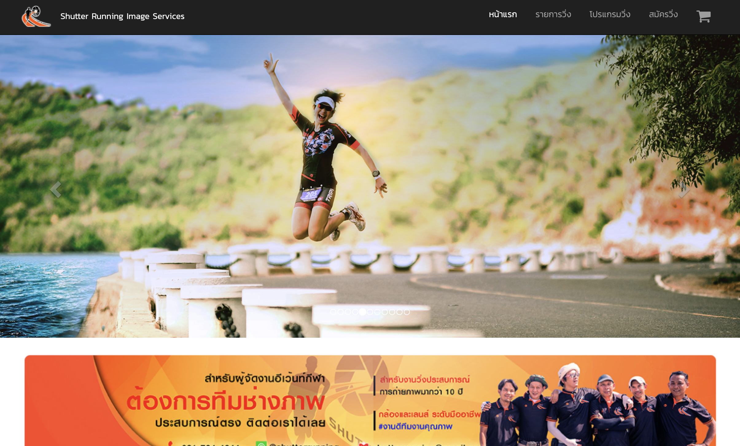
ShutterRunning Image Service
Kasetsart University
Kasetsart University
Ministry of Public Health
Department of Environment Promotion
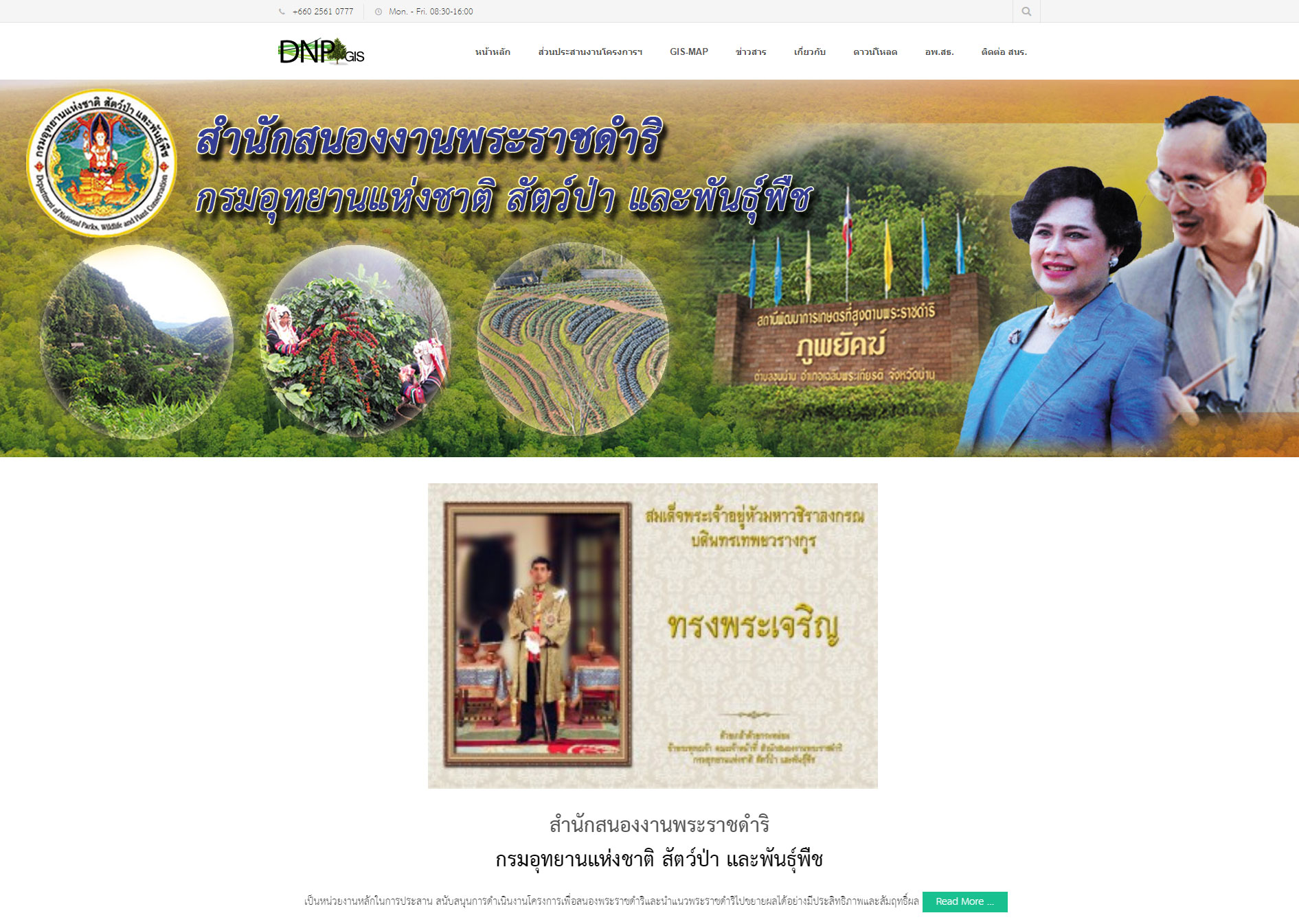
Department of National Parks, Wildlife and Plant Conservation
Department of National Parks, Wildlife and Plant Conservation (DNP)use Vallaris platform for storing location data of forest plantation area and social activies of Royally Initiated Project. The data maintenance by Protected Areas Regional Office, regional office. Main purpose is tracking and monitoring plantation area according to budget allocation.
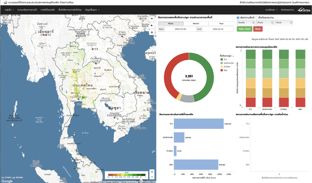
GISTDA Agriculture Online
The National Geo-Informatics Board
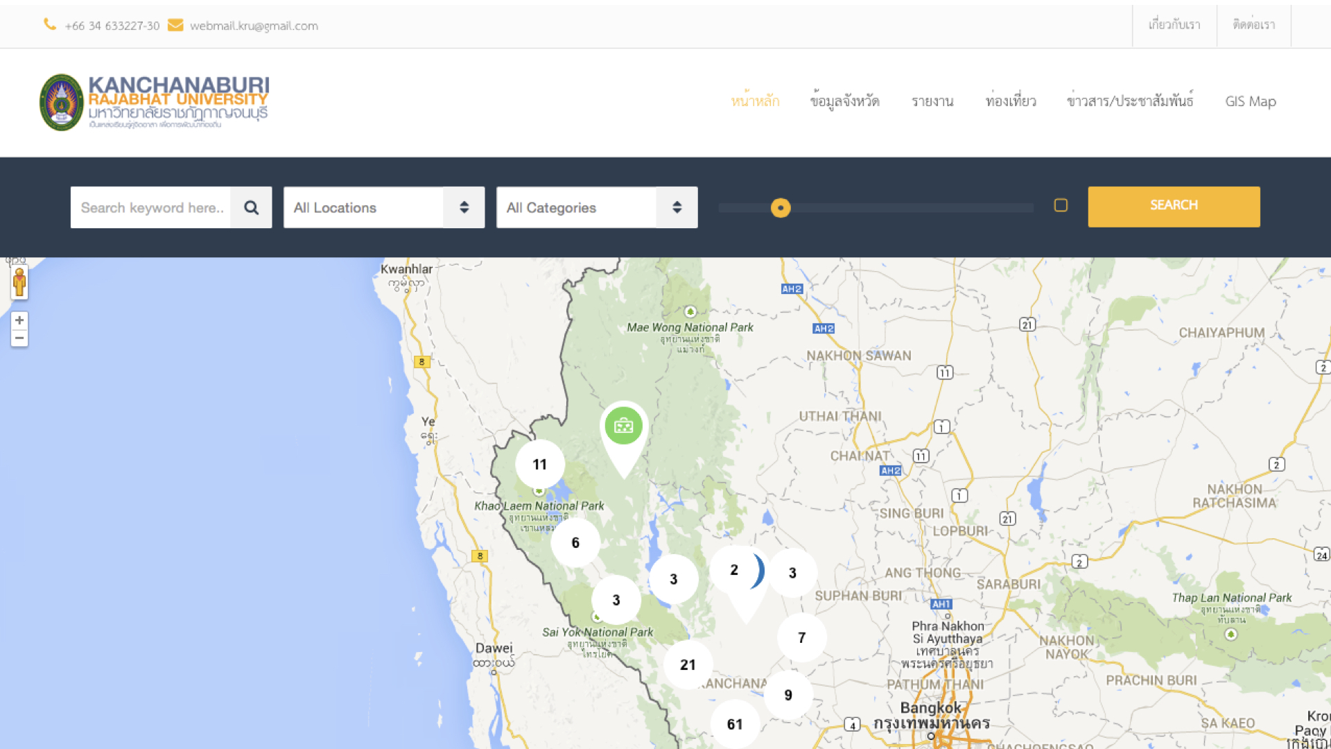
Kanjanaburi Rajabhat University
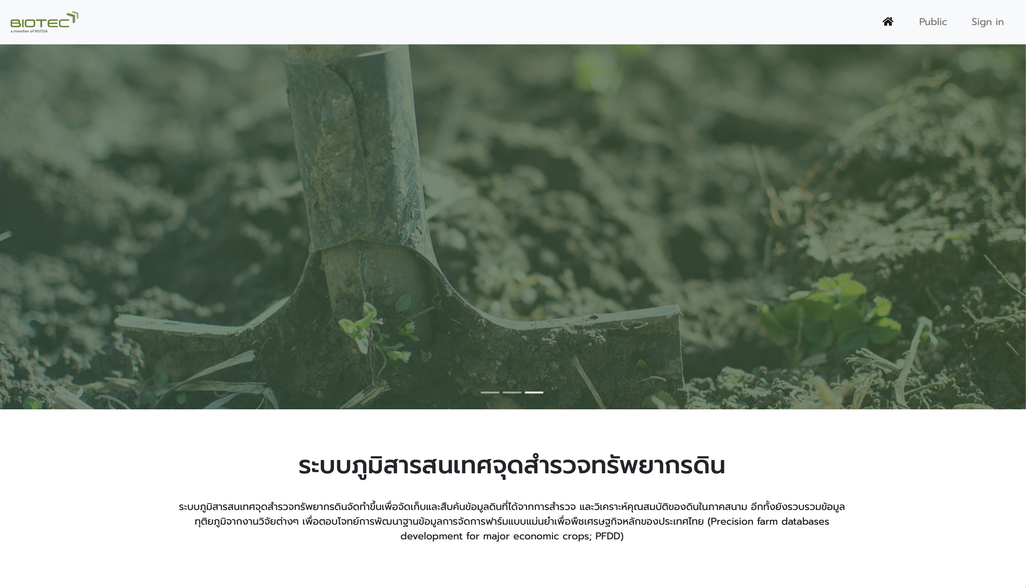
BIOTEC- National Science and Technology Development Agency (NSTDA)
Soil Map application of the National Center for Genetic Engineering and Biotechnology (BIOTEC) is research center under the umbrella of the National Science and Technology Development Agency (NSTDA), the project was designed for storing soil survey data from researcher and soil profile database from Land Development Department. Application was providing public access soil profile data. Vallaris is backend application store boring location and its information.
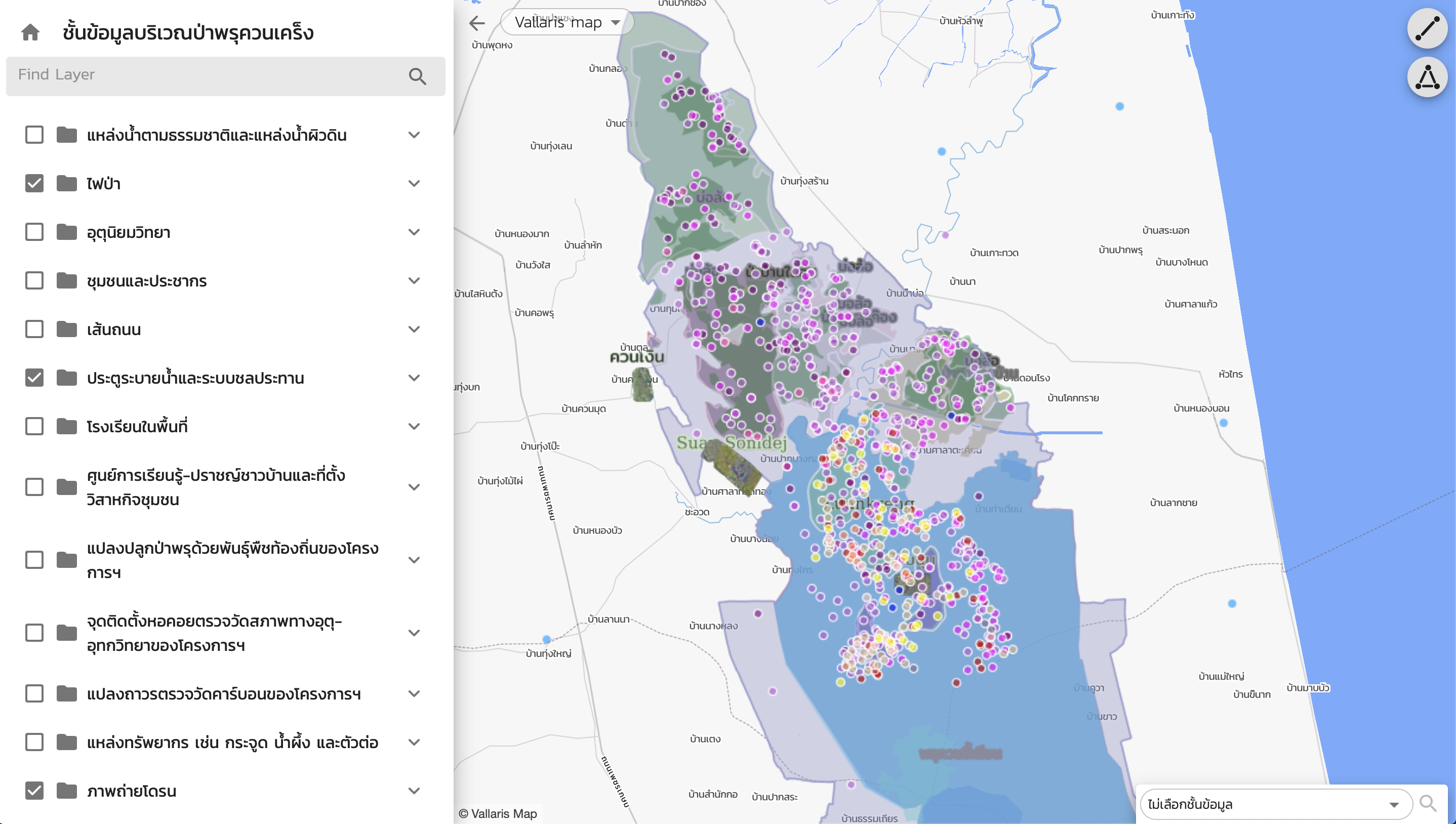
Swamp Forest Map Application
Swamp Forest Map Application is web-map based application for visualized spatial data which has more 30 layers. This application use Vallaris ReactJS map library that most easiest way to build map application.
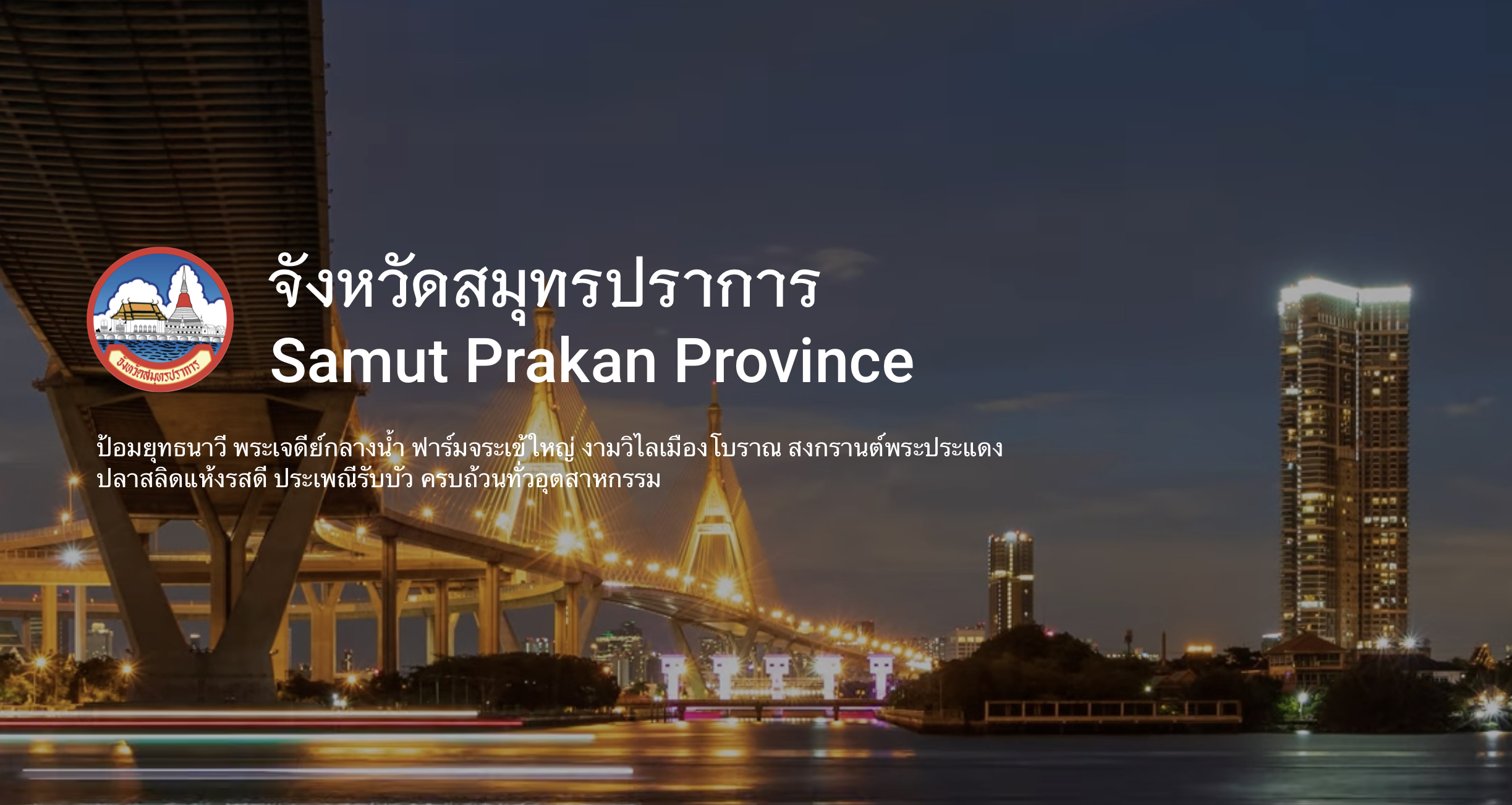
Samut Prakan Provincial Website
Content Mangement System
Samut Prakan Provincial Website was built by the leading CMS software. This website including province information for public access. Samut Prakan needs to share news, information with the community through website for the governance organization.
1371 Suite 10 Capital Mansion, Phahonyothin Rd, Phayathai, Bangkok, 10400 Thailand
email: [email protected]
Phone: +662-278-7913
Facebook :ibitzgeomatics
Instagram : ibitzgeomatics
Contact our company
i-bitz company limited
Head Quarter
1371 Suite 10 Capital Mansion, Phahonyothin Rd, Phayathai, Bangkok, 10400 Thailand
email: [email protected]
Phone: +662-278-7913
Facebook :ibitzgeomatics
Instagram : ibitzgeomatics
Spatial Innovation Lab
Khon Kaen University Science Park
123 Village No.16 Phimol Kolkitch Building, Khon Kaen University, Thailand, 40002
Give us a call or drop by anytime, we endeavour to answer all enquiries within 24 hours on business days.
We are open from 08:00 — 18:00 week days.